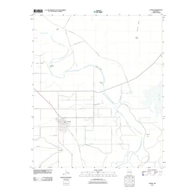
2010 Map of Loving
USGS Topo · Published 2010About this map
The Pecos River carves a winding path through this corner of Eddy County, defining the agricultural and geological character of the region. The settlement of Loving serves as the local anchor, featuring the Loving Post Office and an organized grid of streets surrounded by expansive irrigation works. This hydraulic network is central to the area's development, evidenced by the Southern Canal, Harroun Ditch, and Harroun Dam, which divert water to support local operations like the Dickson Farm.
Find a feature on this map
46 named features on this map. Tap any name to fly to it.
Don’t see what you’re looking for? This feature index may not catch every label — zoom into the map to look around manually.
Map Details
Editions of this 2010 Loving Map
This is the sole edition of this map. No revisions or reprints were ever made.
Other maps of this area

1939 · Carlsbad
USGS Topo · 1:62,500

1939 · Nash Draw
USGS Topo · 1:62,500

1943 · Carlsbad
USGS Topo · 1:62,500

1943 · Nash Draw
USGS Topo · 1:62,500

1945 · Malaga
USGS Topo · 1:62,500

1946 · Malaga
USGS Topo · 1:62,500

1954 · Carlsbad
USGS Topo · 1:250,000

1954 · Hobbs
USGS Topo · 1:250,000

1958 · Carlsbad
USGS Topo · 1:250,000

1958 · Hobbs
USGS Topo · 1:250,000