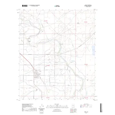
2023 Map of Loving
USGS Topo · Published 2023About this map
The Pecos River carves a winding path through this southeastern New Mexico landscape, defining the character of the settlement at Loving. This agrarian and industrial corridor is heavily shaped by water management, where the Southern Canal and Harroun Ditch divert resources to the surrounding fields. The importance of the regional mining industry is evident in the path of Potash Mines Rd cutting across the eastern plains toward Salt Lake.
Find a feature on this map
62 named features on this map. Tap any name to fly to it.
Don’t see what you’re looking for? This feature index may not catch every label — zoom into the map to look around manually.
Map Details
Editions of this 2023 Loving Map
This is the sole edition of this map. No revisions or reprints were ever made.
Other maps of this area

1939 · Carlsbad
USGS Topo · 1:62,500

1939 · Nash Draw
USGS Topo · 1:62,500

1943 · Carlsbad
USGS Topo · 1:62,500

1943 · Nash Draw
USGS Topo · 1:62,500

1945 · Malaga
USGS Topo · 1:62,500

1946 · Malaga
USGS Topo · 1:62,500

1954 · Carlsbad
USGS Topo · 1:250,000

1954 · Hobbs
USGS Topo · 1:250,000

1958 · Carlsbad
USGS Topo · 1:250,000

1958 · Hobbs
USGS Topo · 1:250,000