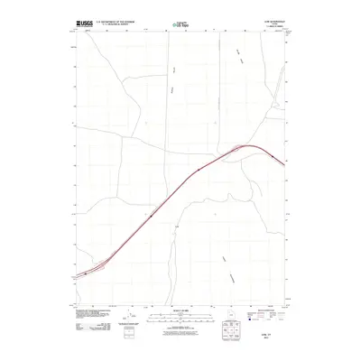
2011 Map of Low
USGS Topo · Published 2011About this map
Low sits as a lonely geographic point amidst the wide expanse of the eastern Cedar Mountains and the flat reaches of Puddle Valley. This 2011 survey captures a landscape defined by transit and military presence, where the modern interstate corridor is flanked by Frontage Rd and the historical path of Hastings Pass Rd. The northeastern portion of the quadrangle is occupied by the restricted grounds of Hill Air Force Base, highlighting the strategic use of this arid terrain. Topographic variations are most pronounced along Skunk Ridge, providing a stark contrast to the surrounding valley floors. For historians and researchers, the map documents the intersection of modern transportation infrastructure and large-scale federal land management in a sparsely populated section of the Great Basin.
Find a feature on this map
7 named features on this map. Tap any name to fly to it.
Don’t see what you’re looking for? This feature index may not catch every label — zoom into the map to look around manually.
Map Details
Editions of this 2011 Low Map
This is the sole edition of this map. No revisions or reprints were ever made.
Other maps of this area

1885 · Tooele Valley
USGS Topo · 1:250,000

1953 · Tooele
USGS Topo · 1:250,000

1955 · Tooele
USGS Topo · 1:250,000

1968 · Craner Peak
USGS Topo · 1:24,000

1973 · Ripple Valley
USGS Topo · 1:24,000

1973 · Grassy Mountains
USGS Topo · 1:24,000

1973 · Delle
USGS Topo · 1:24,000

1973 · Hastings Pass NE
USGS Topo · 1:24,000

1973 · Low
USGS Topo · 1:24,000

1973 · Hastings Pass
USGS Topo · 1:24,000