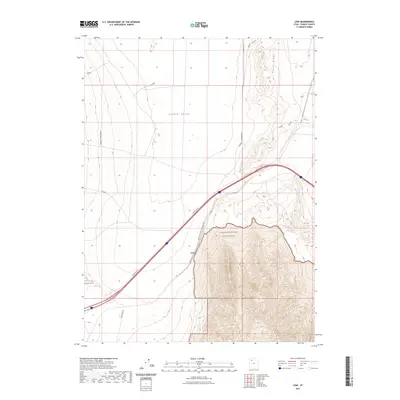
2023 Map of Low
USGS Topo · Published 2023About this map
Low sits at a critical junction in the Tooele County desert where the Western Pacific Railroad Ags cuts through the gap between the Cedar Mountains and the Grassy Mountains. This 2023 survey illustrates a landscape defined by the logistics of transport and preservation, with the modern transit corridor of Frontage Rd running parallel to the historic rail line. The eastern portion of the map is dominated by the protected peaks of the Cedar Mountain Wilderness, providing a stark topographical contrast to the expansive, flat basin of Puddle Valley to the north. Smaller landmarks like Skunk Ridge and utilitarian features such as Gravel Site Rd and Aragonite Rd indicate the area's continued use for resource access and travel through this arid interior basin of the Great Salt Lake Desert.
Find a feature on this map
11 named features on this map. Tap any name to fly to it.
Don’t see what you’re looking for? This feature index may not catch every label — zoom into the map to look around manually.
Map Details
Editions of this 2023 Low Map
This is the sole edition of this map. No revisions or reprints were ever made.
Other maps of this area

1885 · Tooele Valley
USGS Topo · 1:250,000

1953 · Tooele
USGS Topo · 1:250,000

1955 · Tooele
USGS Topo · 1:250,000

1968 · Craner Peak
USGS Topo · 1:24,000

1973 · Ripple Valley
USGS Topo · 1:24,000

1973 · Grassy Mountains
USGS Topo · 1:24,000

1973 · Delle
USGS Topo · 1:24,000

1973 · Hastings Pass NE
USGS Topo · 1:24,000

1973 · Low
USGS Topo · 1:24,000

1973 · Hastings Pass
USGS Topo · 1:24,000