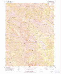
1993 Map of Lowe Peak
USGS Topo · Published 1993About this map
The high ridges of the Oquirrh Mountains dominate this 1993 revision, which traces a landscape defined by mining history and steep topography. Centered on the rugged spine separating Tooele and Salt Lake counties, the map highlights the proximity of resource extraction to high-altitude peaks like Lowe Peak and Kelsey Peak. The settlement of Ophir sits at the southern edge, serving as a gateway to the complex network of canyons and gulches that characterize the range.
Find a feature on this map
88 named features on this map. Tap any name to fly to it.
Don’t see what you’re looking for? This feature index may not catch every label — zoom into the map to look around manually.
Map Details
Editions of this 1993 Lowe Peak Map
This is the sole edition of this map. No revisions or reprints were ever made.
Other maps of this area
1885 · Tooele Valley
USGS Topo · 1:250,000
1915 · Fairfield
USGS Topo · 1:62,500
1917 · Fairfield
USGS Topo · 1:62,500
1918 · Stockton
USGS Topo · 1:62,500
1952 · Bingham Canyon
USGS Topo · 1:24,000
1952 · Lark
USGS Topo · 1:24,000
1953 · Tooele
USGS Topo · 1:250,000
1954 · Tickville Spring
USGS Topo · 1:24,000
1955 · Stockton
USGS Topo · 1:62,500
1955 · Tooele
USGS Topo · 1:250,000