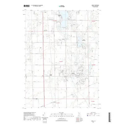
2019 Map of Lowell
USGS Topo · Published 2019About this map
Lowell serves as the primary urban hub in this southern Lake County landscape, where the residential grids of the town meet the agricultural stretches and wetlands of Northwest Indiana. The area is defined by its water and drainage network, including the substantial Cedar Lake to the north and the smaller Lake Dalecarlia and Lake Bel-Aire to the east. These water bodies are connected by a system of man-made and natural channels such as McConnel Ditch and Cedar Cr.
Find a feature on this map
77 named features on this map. Tap any name to fly to it.
Don’t see what you’re looking for? This feature index may not catch every label — zoom into the map to look around manually.
Map Details
Editions of this 2019 Lowell Map
This is the sole edition of this map. No revisions or reprints were ever made.
Other maps of this area

1922 · Momence
USGS Topo · 1:62,500

1924 · Momence
USGS Topo · 1:62,500

1929 · Dyer
USGS Topo · 1:24,000

1930 · Dyer
USGS Topo · 1:24,000

1949 · Crete
USGS Topo · 1:62,500

1953 · Leroy
USGS Topo · 1:24,000

1953 · St. John
USGS Topo · 1:24,000

1953 · Crown Point
USGS Topo · 1:24,000

1953 · Beecher East
USGS Topo · 1:24,000
1953 · Dyer
USGS Topo · 1:24,000