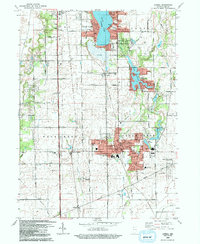
1992 Map of Lowell
USGS Topo · Published 1992About this map
Lowell serves as the primary urban center in this South Lake County landscape, where the residential grids of the town meet the agricultural expanses of West Creek and Cedar Creek townships. The map illustrates a region defined by its water bodies and recreational heritage, from the densely developed shores of Cedar Lake and Lake Dalecarlia to the smaller Lake Bel-Aire. Genealogists will find significant value in the documentation of local burial sites, including the German Cem and Lake Prairie Cem, alongside numerous country churches like Bethany Chapel and St Edwards Ch. The transition from rural to suburban is evident in the cluster of schools such as Oak Hill Sch and Three Creeks Sch, while the preservation of local history is anchored by the Buckley Homestead County Park in the southeast.
Find a feature on this map
57 named features on this map. Tap any name to fly to it.
Don’t see what you’re looking for? This feature index may not catch every label — zoom into the map to look around manually.
Map Details
Editions of this 1992 Lowell Map
This is the sole edition of this map. No revisions or reprints were ever made.
Other maps of this area

1922 · Momence
USGS Topo · 1:62,500

1924 · Momence
USGS Topo · 1:62,500

1929 · Dyer
USGS Topo · 1:24,000

1930 · Dyer
USGS Topo · 1:24,000

1949 · Crete
USGS Topo · 1:62,500

1953 · Leroy
USGS Topo · 1:24,000

1953 · St. John
USGS Topo · 1:24,000

1953 · Crown Point
USGS Topo · 1:24,000

1953 · Beecher East
USGS Topo · 1:24,000
1953 · Dyer
USGS Topo · 1:24,000