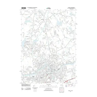
2012 Map of Lowell
USGS Topo · Published 2012About this map
Industrial heritage along the Merrimack River characterizes this study of the region, where the convergence with the Concord River fostered a dense manufacturing core. The legacy of the textile era is legible in the cluster of landmarks near Pawtucket Falls, including the Boott Mills, Suffolk Mill Turbine Exhibit, and Appleton Mill. These sites, alongside institutional anchors like Middlesex Community College and the State Teachers College, show a landscape transitioned from its nineteenth-century industrial peak into a modern educational and residential hub.
Find a feature on this map
87 named features on this map. Tap any name to fly to it.
Don’t see what you’re looking for? This feature index may not catch every label — zoom into the map to look around manually.
Map Details
Editions of this 2012 Lowell Map
This is the sole edition of this map. No revisions or reprints were ever made.
Other maps of this area

1886 · Lawrence
USGS Topo · 1:62,500

1886 · Lowell
USGS Topo · 1:62,500

1888 · Haverhill
USGS Topo · 1:62,500

1888 · Lawrence
USGS Topo · 1:62,500

1890 · Haverhill
USGS Topo · 1:62,500

1893 · Lowell
USGS Topo · 1:62,500

1893 · Lawrence
USGS Topo · 1:62,500

1893 · Haverhill
USGS Topo · 1:62,500

1905 · Manchester
USGS Topo · 1:62,500

1918 · Lowell
USGS Topo · 1:62,500