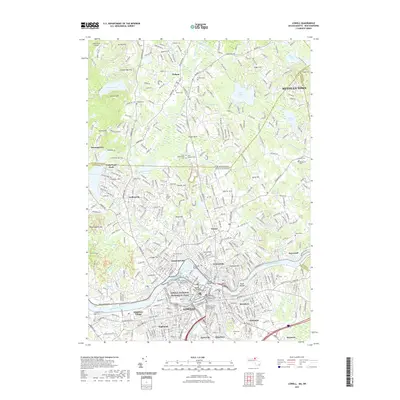
2021 Map of Lowell
USGS Topo · Published 2021About this map
The industrial legacy of the Merrimack River dominates this modern landscape, centered on the historic mill city of Lowell. The map highlights the Lowell National Historical Park and the preserved engineering of the Northern Canal, alongside the established campuses of the University of Massachusetts Lowell and Middlesex Community College Lowell Campus. Settlement patterns extend north into Dracut and Pelham, crossing the New Hampshire-Massachusetts state line.
Find a feature on this map
75 named features on this map. Tap any name to fly to it.
Don’t see what you’re looking for? This feature index may not catch every label — zoom into the map to look around manually.
Map Details
Editions of this 2021 Lowell Map
This is the sole edition of this map. No revisions or reprints were ever made.
Other maps of this area

1886 · Lawrence
USGS Topo · 1:62,500

1886 · Lowell
USGS Topo · 1:62,500

1888 · Haverhill
USGS Topo · 1:62,500

1888 · Lawrence
USGS Topo · 1:62,500

1890 · Haverhill
USGS Topo · 1:62,500

1893 · Lowell
USGS Topo · 1:62,500

1893 · Lawrence
USGS Topo · 1:62,500

1893 · Haverhill
USGS Topo · 1:62,500

1905 · Manchester
USGS Topo · 1:62,500

1918 · Lowell
USGS Topo · 1:62,500