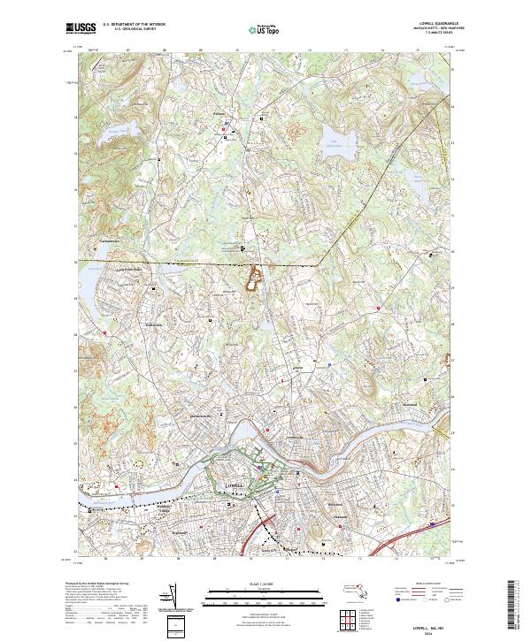
2024 Map of Lowell
USGS Topo · Published 2024About this map
The Merrimack River serves as the industrial and geographical heart of this region, winding past the urban center of Lowell and through a landscape defined by 19th-century hydraulic engineering. The map details the sophisticated waterway system of the Northern Canal and Pawtucket Canal, which powered the textile mills that spurred the area's growth. These historic corridors are now preserved within the Lowell National Historical Park. Surrounding the city, the residential and educational fabric is represented by the University of Massachusetts Lowell and established neighborhoods like Centralville, Belvidere, and Highlands. North of the state line in Pelham, the terrain transitions to a series of glacial hills such as Jeremy Hill and Gage Hill. Numerous family and community burial grounds, including Pelham Center Cem and the Montefiore Israel Brotherhood Cem, provide significant points of interest for genealogical research across the Massachusetts and New Hampshire border.
Find a feature on this map
76 named features on this map. Tap any name to fly to it.
Don’t see what you’re looking for? This feature index may not catch every label — zoom into the map to look around manually.
Map Details
Editions of this 2024 Lowell Map
This is the sole edition of this map. No revisions or reprints were ever made.
Other maps of this area

1886 · Lawrence
USGS Topo · 1:62,500

1886 · Lowell
USGS Topo · 1:62,500

1888 · Haverhill
USGS Topo · 1:62,500

1888 · Lawrence
USGS Topo · 1:62,500

1890 · Haverhill
USGS Topo · 1:62,500

1893 · Lowell
USGS Topo · 1:62,500

1893 · Lawrence
USGS Topo · 1:62,500

1893 · Haverhill
USGS Topo · 1:62,500

1905 · Manchester
USGS Topo · 1:62,500

1918 · Lowell
USGS Topo · 1:62,500