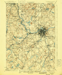
1935 Map of Lowell
USGS Topo · Published 1941About this map
The Merrimack River serves as the industrial and geographical anchor of this mid-1930s landscape, winding through the dense urban core of Lowell and its outlying neighborhoods like Centralville and Pawtucketville. This era captures the region's complex transit network, where the established Boston and Maine Railroad and the Framingham and Lowell Railroad intersect with the developing Daniel Webster Highway. To the north, the boundary between New Hampshire and Massachusetts bisects rural tracts in Pelham and Hudson, where local life centered around neighborhood institutions like Gumpas Pd Sch and St Marie Convent. In the surrounding townships of Chelmsford and Westford, the map documents numerous small ponds and granite-named landmarks such as Flat Rock Quarry and Graniteville, reflecting the region's geological and economic character before post-war suburban expansion.
Find a feature on this map
152 named features on this map. Tap any name to fly to it.
Don’t see what you’re looking for? This feature index may not catch every label — zoom into the map to look around manually.
Map Details
Editions of this 1935 Lowell Map
3 editions found
Other maps of this area

1886 · Lawrence
USGS Topo · 1:62,500

1886 · Lowell
USGS Topo · 1:62,500

1886 · Framingham
USGS Topo · 1:62,500

1887 · Marlboro
USGS Topo · 1:62,500

1888 · Haverhill
USGS Topo · 1:62,500

1888 · Lawrence
USGS Topo · 1:62,500

1889 · Marlboro
USGS Topo · 1:62,500

1889 · Framingham
USGS Topo · 1:62,500

1890 · Haverhill
USGS Topo · 1:62,500

1893 · Lowell
USGS Topo · 1:62,500