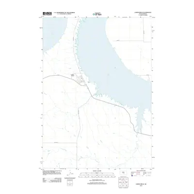
2012 Map of Lower Brule
USGS Topo · Published 2012About this map
Lake Sharpe dominates the eastern half of this landscape, its expansive waters formed by the Missouri River's damming. At the heart of the region's human geography is Council House, a key settlement node where local roads converge. The topography is defined by the drainage patterns of Counselor Cr, which winds through the southern reaches toward the lake. Bureau of Indian Affairs infrastructure is prominent, with arterial routes like Bia Route 3 and Bia Route 10 providing the primary connectivity across this tribal land. The map reveals a transition between the developed community at Council House and the surrounding rangeland, characterized by a sparse grid of rural roads including 228th St and 334th Ave.
Find a feature on this map
8 named features on this map. Tap any name to fly to it.
Don’t see what you’re looking for? This feature index may not catch every label — zoom into the map to look around manually.
Map Details
Editions of this 2012 Lower Brule Map
This is the sole edition of this map. No revisions or reprints were ever made.
Other maps of this area

1935 · Chamberlain
USGS Topo · 1:62,500

1939 · Chamberlain
USGS Topo · 1:62,500

1953 · Huron
USGS Topo · 1:250,000

1954 · Huron
USGS Topo · 1:250,000

1955 · Mitchell
USGS Topo · 1:250,000

1959 · Mitchell
USGS Topo · 1:250,000

1966 · Lower Brule NW
USGS Topo · 1:24,000

1966 · Stephan
USGS Topo · 1:24,000

1966 · Big Bend Dam
USGS Topo · 1:24,000

1966 · Lower Brule SW
USGS Topo · 1:24,000
Featured Places
- Big Bend District, SD
- Council House, SD
- Lower Brule, SD
- Fort Thompson District, SD
- Grey Hill West Township, Fort Thompson District