
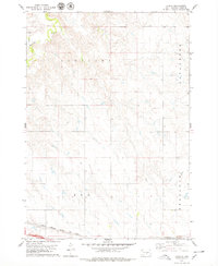
1966 Map of Lower Brule SW
USGS Topo · Published 1967About this map
Lake Sharpe dominates the northern landscape of this South Dakota survey, illustrating the managed waters of the Missouri River as they flow between the Lower Brule Indian Reservation Boundary and Crow Creek Indian Reservation Boundary. The terrain south of the river is defined by the winding course of Medicine Creek and the expansive reach of Pleasant Valley. These watercourses provided the essential lifelines for ranching and settlement in a region marked by its distinct breaks and drainage basins.
Find a feature on this map
14 named features on this map. Tap any name to fly to it.
Don’t see what you’re looking for? This feature index may not catch every label — zoom into the map to look around manually.
Map Details
Editions of this 1966 Lower Brule SW Map
This is the sole edition of this map. No revisions or reprints were ever made.
Other maps of this area

1953 · Huron
USGS Topo · 1:250,000

1954 · Huron
USGS Topo · 1:250,000

1955 · Mitchell
USGS Topo · 1:250,000

1959 · Mitchell
USGS Topo · 1:250,000

1966 · Lower Brule NW
USGS Topo · 1:24,000

1966 · Joe Creek
USGS Topo · 1:24,000

1966 · Joe Creek SE
USGS Topo · 1:24,000

1966 · Lower Brule NE
USGS Topo · 1:24,000

1966 · Lower Brule
USGS Topo · 1:24,000
1978 · Lyman
USGS Topo · 1:24,000