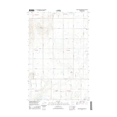
2017 Map of Lower Crow Reservoir
USGS Topo · Published 2017About this map
The Lower Crow Reservoir and the extensive network of the Pablo 10A and 37A Canals define this agrarian landscape south of Pablo. The terrain transitions from the elevated Valley View Hills in the northwest to the distinct volcanic profiles of Round Butte and Sloan Buttes in the south. This area, mapped in the late 2010s, demonstrates a sophisticated irrigation system that manages water from the Pablo Reservoir through various canals like the Pablo 71A Canal and Pablo 70A Canal. This hydraulic infrastructure supports the valley's settlement patterns, where roads such as Stagecoach Trl and Round Butte Rd W follow the contours of the land. The presence of Sloan Lake and the drainage of Mud Creek through West Miller Coulee reflect a complex natural and engineered watershed essential to the region's agricultural character.
Find a feature on this map
60 named features on this map. Tap any name to fly to it.
Don’t see what you’re looking for? This feature index may not catch every label — zoom into the map to look around manually.
Map Details
Editions of this 2017 Lower Crow Reservoir Map
This is the sole edition of this map. No revisions or reprints were ever made.
Other maps of this area

1920 · Flathead Lake
USGS Topo · 1:125,000

1956 · Wallace
USGS Topo · 1:250,000

1960 · Wallace
USGS Topo · 1:250,000

1964 · Buffalo Bridge
USGS Topo · 1:24,000

1964 · East Bay
USGS Topo · 1:24,000

1964 · Fort Connah
USGS Topo · 1:24,000

1964 · Polson
USGS Topo · 1:24,000

1964 · Ronan
USGS Topo · 1:24,000

1964 · Lower Crow Reservoir
USGS Topo · 1:24,000

1965 · Sloan
USGS Topo · 1:24,000