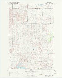
1988 Map of Lower Crow Reservoir
USGS Topo · Published 1988About this map
The Valley View Hills and the prominent volcanic landmark of Round Butte define the topography of this portion of the Flathead Indian Reservation during the late 1980s. A sophisticated network of water management is evident throughout the landscape, anchored by the Pablo Canal and several coulees that feed into the Lower Crow Reservoir and Crow Creek. This irrigation infrastructure allowed for agricultural development on the plateau, supported by a transportation network that includes the Northern Pacific railroad line cutting through the southeastern corner. The map also captures the northern extent of the Pablo National Wildlife Refuge, where the terrain transitions from managed waterways like West Miller Coulee to protected wetlands and smaller bodies of water such as Sloan Lake.
Find a feature on this map
16 named features on this map. Tap any name to fly to it.
Don’t see what you’re looking for? This feature index may not catch every label — zoom into the map to look around manually.
Map Details
Editions of this 1988 Lower Crow Reservoir Map
This is the sole edition of this map. No revisions or reprints were ever made.
Other maps of this area

1920 · Flathead Lake
USGS Topo · 1:125,000

1956 · Wallace
USGS Topo · 1:250,000

1960 · Wallace
USGS Topo · 1:250,000

1964 · Buffalo Bridge
USGS Topo · 1:24,000

1964 · East Bay
USGS Topo · 1:24,000

1964 · Fort Connah
USGS Topo · 1:24,000

1964 · Polson
USGS Topo · 1:24,000

1964 · Ronan
USGS Topo · 1:24,000

1964 · Lower Crow Reservoir
USGS Topo · 1:24,000

1965 · Sloan
USGS Topo · 1:24,000