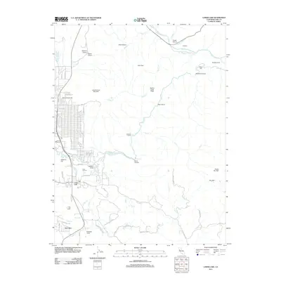
2012 Map of Lower Lake
USGS Topo · Published 2012About this map
Lower Lake serves as the primary hub in this 2012 survey, where the convergence of Seigler Canyon Cr and Cache Cr defines the local topography. This landscape is characterized by a mix of rugged highlands and small agricultural valleys, including Excelsior Valley and Anderson Flat. Notable landmarks like the Lower Lake Winery and Pearce Airport highlight the modern rural economy of Lake County. Local history is anchored at the Lower Lake Cem, situated near the winding Morgan Valley Rd. The terrain rises sharply to peaks like Bally Peak and Quackenbush Mountain, while narrow passages such as Redbank Gorge and Stag Canyon reveal the complex drainage patterns feeding toward the Clear Lake basin. This map provides a detailed look at the road network and property boundaries that shape this community.
Find a feature on this map
71 named features on this map. Tap any name to fly to it.
Don’t see what you’re looking for? This feature index may not catch every label — zoom into the map to look around manually.
Map Details
Editions of this 2012 Lower Lake Map
This is the sole edition of this map. No revisions or reprints were ever made.
Other maps of this area

1920 · Venado
USGS Topo · 1:62,500

1924 · Bartlett Springs
USGS Topo · 1:62,500

1942 · Bartlett Springs
USGS Topo · 1:62,500

1943 · Morgan Valley
USGS Topo · 1:62,500

1944 · Bartlett Springs
USGS Topo · 1:62,500

1944 · Wilbur Springs
USGS Topo · 1:62,500

1944 · Morgan Valley
USGS Topo · 1:62,500

1945 · Lower Lake
USGS Topo · 1:62,500

1947 · Santa Rosa
USGS Topo · 1:250,000

1949 · Santa Rosa
USGS Topo · 1:250,000