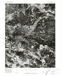
1977 Map of Lower Lake
USGS Topo · Published 1980About this map
Lower Lake sits at the nexus of the valley floor and rising woodland in this 1977 orthophotograph, which provides a stark visual record of the settlement pattern in Lake County during the late seventies. The aerial imagery captures the distinct grain of the landscape where the agricultural flats of Excelsior Valley meet the drainage of Cache Creek. This specific survey emphasizes the distribution of structures and the clearing of land for residential and agricultural use, contrasting the dense development of the town center against the surrounding vegetation and creek-side terrain. It is a precise baseline for understanding the growth of this interior California community before later modern expansions changed the footprint of the valley floor.
Find a feature on this map
3 named features on this map. Tap any name to fly to it.
Don’t see what you’re looking for? This feature index may not catch every label — zoom into the map to look around manually.
Map Details
Editions of this 1977 Lower Lake Map
This is the sole edition of this map. No revisions or reprints were ever made.
Other maps of this area

1920 · Venado
USGS Topo · 1:62,500

1924 · Bartlett Springs
USGS Topo · 1:62,500

1942 · Bartlett Springs
USGS Topo · 1:62,500

1943 · Morgan Valley
USGS Topo · 1:62,500

1944 · Bartlett Springs
USGS Topo · 1:62,500

1944 · Wilbur Springs
USGS Topo · 1:62,500

1944 · Morgan Valley
USGS Topo · 1:62,500

1945 · Lower Lake
USGS Topo · 1:62,500

1947 · Santa Rosa
USGS Topo · 1:250,000

1949 · Santa Rosa
USGS Topo · 1:250,000