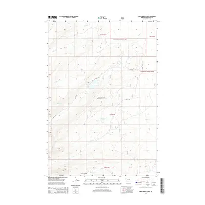
2014 Map of Lower Miner Lakes
USGS Topo · Published 2014About this map
Beaverhead National Forest defines the landscape of this high-elevation Montana region, where a complex network of mountain drainages feeds into the Lower Miner Lakes. The terrain is characterized by a series of alpine meadows and clearings, including Gravelle Park and Berry Meadows, which provide breaks in the timbered slopes. Transportation through this remote section of Beaverhead County is primarily limited to forest routes like Miner Lake Rd and Englejard Rd, which track the contours of the land to reach significant water bodies like Englejard Lake. Numerous tributaries such as Miner Cr, Hamby Cr, and Little Lake Cr carve through the mountain ranges, illustrating the natural water management of the Continental Divide's eastern slopes during the early 21st century.
Find a feature on this map
29 named features on this map. Tap any name to fly to it.
Don’t see what you’re looking for? This feature index may not catch every label — zoom into the map to look around manually.
Map Details
Editions of this 2014 Lower Miner Lakes Map
This is the sole edition of this map. No revisions or reprints were ever made.
Other maps of this area

1955 · Dillon
USGS Topo · 1:250,000

1956 · Goldstone Mtn
USGS Topo · 1:62,500

1957 · Dillon
USGS Topo · 1:250,000

1958 · Dillon
USGS Topo · 1:250,000

1962 · Dillon
USGS Topo · 1:250,000

1965 · Dillon
USGS Topo · 1:250,000

1966 · Miner Lake
USGS Topo · 1:24,000

1966 · Jumbo Mountain
USGS Topo · 1:24,000
1966 · Ajax Ranch
USGS Topo · 1:24,000
1966 · Homer Youngs Peak
USGS Topo · 1:24,000