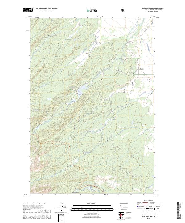
2024 Map of Lower Miner Lakes
USGS Topo · Published 2024About this map
Beaverhead National Forest defines this high-elevation landscape in southwest Montana, where a complex network of glacial drainage systems feeds into the Lower Miner Lakes. The presence of the Jackson Miner Ditch in the northeast corner of the quadrangle indicates historical water management for mining or irrigation, contrasting with the wilderness character of the Continental Divide National Scenic Trl that winds through the southern ridges. Small open clearings like Gravelle Park and Berry Meadows break the dense forest cover, providing distinct landmarks for those navigating the area via Miner Lake Rd. The map documents a hydrographic system dominated by Miner Creek and Englejard Creek, which flow through steep drainages toward Englejard Lake.
Find a feature on this map
23 named features on this map. Tap any name to fly to it.
Don’t see what you’re looking for? This feature index may not catch every label — zoom into the map to look around manually.
Map Details
Editions of this 2024 Lower Miner Lakes Map
This is the sole edition of this map. No revisions or reprints were ever made.
Other maps of this area

1955 · Dillon
USGS Topo · 1:250,000

1956 · Goldstone Mtn
USGS Topo · 1:62,500

1957 · Dillon
USGS Topo · 1:250,000

1958 · Dillon
USGS Topo · 1:250,000

1962 · Dillon
USGS Topo · 1:250,000

1965 · Dillon
USGS Topo · 1:250,000

1966 · Miner Lake
USGS Topo · 1:24,000

1966 · Jumbo Mountain
USGS Topo · 1:24,000
1966 · Ajax Ranch
USGS Topo · 1:24,000
1966 · Homer Youngs Peak
USGS Topo · 1:24,000