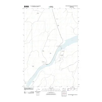
2011 Map of Lower Monumental Dam
USGS Topo · Published 2011About this map
The Snake River carves a deep path through this portion of Franklin County, where the massive infrastructure of the Lower Monumental Dam stands as the central landmark. This 2011 survey reveals a landscape of industrial river management and aviation, featuring both the Lower Monumental State Airport on the southern bank and the Hille-Kimp Airstrip to the north. Small settlements and rail-related points like Windust, Farrington, and Scott line the river's edge, marking the historical transit corridor through the canyon. The surrounding terrain is defined by dramatic geological features, including Devils Canyon, Box Canyon, and Bouvey Canyon, which cut through the high plateau. Road networks like Lower Monumental Rd and Hunt Rd provide access to this specialized engineering site, while the scattered place names like Matthew and Monument recall the area's agricultural and local history before the river was fully harnessed for power.
Find a feature on this map
23 named features on this map. Tap any name to fly to it.
Don’t see what you’re looking for? This feature index may not catch every label — zoom into the map to look around manually.
Map Details
Editions of this 2011 Lower Monumental Dam Map
This is the sole edition of this map. No revisions or reprints were ever made.
Other maps of this area

1915 · Wallulah
USGS Topo · 1:96,000

1916 · Connell
USGS Topo · 1:125,000

1918 · Connell
USGS Topo · 1:125,000

1918 · Wallula
USGS Topo · 1:125,000

1919 · Walla Walla
USGS Topo · 1:125,000

1921 · Walla Walla
USGS Topo · 1:125,000

1948 · Ayer
USGS Topo · 1:62,500

1950 · Haas
USGS Topo · 1:62,500

1953 · Walla Walla
USGS Topo · 1:250,000

1958 · Walla Walla
USGS Topo · 1:250,000