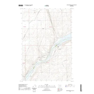
2020 Map of Lower Monumental Dam
USGS Topo · Published 2020About this map
The Snake River carves a deep path through the plateau in this part of Franklin and Walla Walla Counties, anchored by the massive Lower Monumental Dam. The resulting reservoirs, Lake Herbert G West and Lake Sacajawea, have transformed the landscape, inundating previous riverine geography and creating a distinct industrial and recreational corridor. Along the banks, the Columbia Plateau State Park Trail follows the river's winding course, tracing a route through a series of dramatic coulees and canyons such as Dunnigan Coulee and Devils Canyon. Small settlements and landing points like Windust, Farrington, and Scott are scattered along the water's edge. This terrain is further marked by transportation infrastructure essential to the region, including the Lower Monumental State Airport and the Hille Airstrip, which serve this remote stretch of the Pacific Northwest.
Find a feature on this map
35 named features on this map. Tap any name to fly to it.
Don’t see what you’re looking for? This feature index may not catch every label — zoom into the map to look around manually.
Map Details
Editions of this 2020 Lower Monumental Dam Map
This is the sole edition of this map. No revisions or reprints were ever made.
Other maps of this area

1915 · Wallulah
USGS Topo · 1:96,000

1916 · Connell
USGS Topo · 1:125,000

1918 · Connell
USGS Topo · 1:125,000

1918 · Wallula
USGS Topo · 1:125,000

1919 · Walla Walla
USGS Topo · 1:125,000

1921 · Walla Walla
USGS Topo · 1:125,000

1948 · Ayer
USGS Topo · 1:62,500

1950 · Haas
USGS Topo · 1:62,500

1953 · Walla Walla
USGS Topo · 1:250,000

1958 · Walla Walla
USGS Topo · 1:250,000