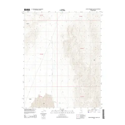
2015 Map of Lower Pahranagat Lake SW
USGS Topo · Published 2015About this map
Desert Lake sits at the southern edge of this arid Nevada landscape, where the valley floor meets the rising elevations of the surrounding mountains. The area is defined by the topographical transition between the Pahranagat Range to the northwest and the northern reaches of the Sheep Range in the east. Alamo Rd provides the primary north-south corridor through the basin, following the natural contours of the valley between these prominent ridges. Water is a scarce and vital resource in this high-desert environment, marked on this survey by the isolated Sheep Mountain Spring. This 2015 study illustrates the enduring spatial relationship between these water sources and the historical routes through the Lincoln County wilderness.
Find a feature on this map
11 named features on this map. Tap any name to fly to it.
Don’t see what you’re looking for? This feature index may not catch every label — zoom into the map to look around manually.
Map Details
Editions of this 2015 Lower Pahranagat Lake SW Map
This is the sole edition of this map. No revisions or reprints were ever made.
Other maps of this area

1907 · Las Vegas
USGS Topo · 1:250,000

1908 · Las Vegas
USGS Topo · 1:250,000

1945 · Sheep Range
USGS Topo · 1:125,000

1945 · Alamo
USGS Topo · 1:125,000

1954 · Caliente
USGS Topo · 1:250,000

1954 · Las Vegas
USGS Topo · 1:250,000

1957 · Las Vegas
USGS Topo · 1:250,000

1959 · Caliente
USGS Topo · 1:250,000

1959 · Las Vegas
USGS Topo · 1:250,000

1962 · Las Vegas
USGS Topo · 1:250,000