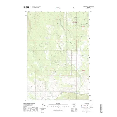
2020 Map of Lower Seymour Lake
USGS Topo · Published 2020About this map
Lower Seymour Lake and the high-altitude drainage systems of the Anaconda Range define this terrain at the border of Beaverhead National Forest and Deerlodge National Forest. The landscape is dominated by the headwaters of numerous creeks, including Seymour Creek and La Marche Creek, which feed eventually toward the Big Hole River in the southern portion of the quadrangle. A notable human imprint on this wilderness is the Bacon Ditch, an irrigation or mining-era water conveyance cutting across the slopes north of the river. The Continental Divide National Scenic Trail traverses the ridges, providing a modern point of reference through a region historically valued for its timber and watershed. Surveyed access is limited to a handful of forest routes like Seymour Creek Rd and Fish Trap Rd, which trace the narrow valley floors.
Find a feature on this map
32 named features on this map. Tap any name to fly to it.
Don’t see what you’re looking for? This feature index may not catch every label — zoom into the map to look around manually.
Map Details
Editions of this 2020 Lower Seymour Lake Map
This is the sole edition of this map. No revisions or reprints were ever made.
Other maps of this area

1908 · Philipsburg
USGS Topo · 1:125,000

1947 · Butte
USGS Topo · 1:250,000

1955 · Dillon
USGS Topo · 1:250,000

1957 · Dillon
USGS Topo · 1:250,000

1958 · Butte
USGS Topo · 1:250,000

1958 · Dillon
USGS Topo · 1:250,000

1960 · Butte
USGS Topo · 1:250,000

1962 · Butte
USGS Topo · 1:250,000

1962 · Dillon
USGS Topo · 1:250,000

1962 · Lincoln Gulch
USGS Topo · 1:24,000