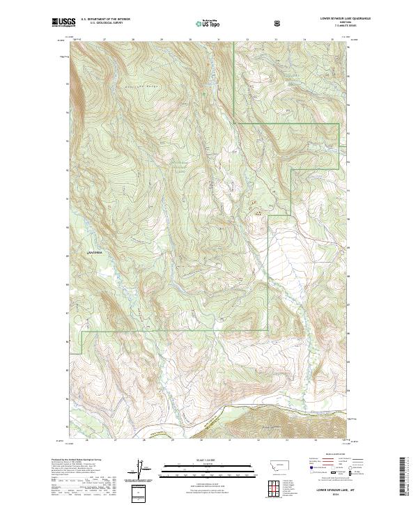
2024 Map of Lower Seymour Lake
USGS Topo · Published 2024About this map
Lower Seymour Lake sits at the heart of this high-elevation landscape, where the Anaconda Range meets the southern reaches of the Deerlodge National Forest. The map documents a complex hydraulic network developed to move water across these mountain slopes, including the Bacon Ditch and the Anderson Ditch, which redirect flow toward the Big Hole River valley. This area represents a meeting point of major protected lands, with the Anaconda Pintler Wilderness occupying the northwestern corner and the Beaverhead National Forest spanning the central and southern portions.
Find a feature on this map
33 named features on this map. Tap any name to fly to it.
Don’t see what you’re looking for? This feature index may not catch every label — zoom into the map to look around manually.
Map Details
Editions of this 2024 Lower Seymour Lake Map
This is the sole edition of this map. No revisions or reprints were ever made.
Other maps of this area

1908 · Philipsburg
USGS Topo · 1:125,000

1947 · Butte
USGS Topo · 1:250,000

1955 · Dillon
USGS Topo · 1:250,000

1957 · Dillon
USGS Topo · 1:250,000

1958 · Butte
USGS Topo · 1:250,000

1958 · Dillon
USGS Topo · 1:250,000

1960 · Butte
USGS Topo · 1:250,000

1962 · Butte
USGS Topo · 1:250,000

1962 · Dillon
USGS Topo · 1:250,000

1962 · Lincoln Gulch
USGS Topo · 1:24,000