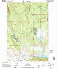
1997 Map of Lower Seymour Lake
USGS Topo · Published 2002About this map
The Big Hole River anchors the southern edge of this landscape at the boundary between Deer Lodge Co and Beaverhead Co. This 1997 revision of 1955 data shows a high-altitude terrain transitioning from the Anaconda Pintler Wilderness in the west through the Beaverhead National Forest and Deerlodge National Forest. Significant water management is evident at the Bacon Ditch, which reroutes natural flows across the rugged topography.
Find a feature on this map
23 named features on this map. Tap any name to fly to it.
Don’t see what you’re looking for? This feature index may not catch every label — zoom into the map to look around manually.
Map Details
Editions of this 1997 Lower Seymour Lake Map
This is the sole edition of this map. No revisions or reprints were ever made.
Other maps of this area

1908 · Philipsburg
USGS Topo · 1:125,000

1947 · Butte
USGS Topo · 1:250,000

1955 · Dillon
USGS Topo · 1:250,000

1957 · Dillon
USGS Topo · 1:250,000

1958 · Butte
USGS Topo · 1:250,000

1958 · Dillon
USGS Topo · 1:250,000

1960 · Butte
USGS Topo · 1:250,000

1962 · Butte
USGS Topo · 1:250,000

1962 · Dillon
USGS Topo · 1:250,000

1962 · Lincoln Gulch
USGS Topo · 1:24,000