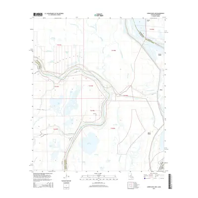
2015 Map of Lower Sunk Lake
USGS Topo · Published 2015About this map
The winding Red River defines the landscape of this river-bottom territory, serving as a shifting border between Concordia Parish and Avoyelles Parish. This area is a complex network of backwaters and seasonal wetlands, dominated by large bodies like Lower Sunk Lake and Upper Sunk Lake. The presence of oxbow-style features such as Grand Cutoff Bayou and Little Cutoff indicates the historical movement of the river channels through the alluvial plain. Human settlement is sparse and primarily clustered along the higher ground of the riverbanks and secondary roads.
Find a feature on this map
48 named features on this map. Tap any name to fly to it.
Don’t see what you’re looking for? This feature index may not catch every label — zoom into the map to look around manually.
Map Details
Editions of this 2015 Lower Sunk Lake Map
This is the sole edition of this map. No revisions or reprints were ever made.
Other maps of this area

1935 · Tooleys
USGS Topo · 1:62,500

1939 · Artonish
USGS Topo · 1:62,500

1939 · Deer Park
USGS Topo · 1:62,500

1941 · Voorhies
USGS Topo · 1:62,500

1941 · Tooleys
USGS Topo · 1:62,500

1953 · Natchez
USGS Topo · 1:250,000

1954 · Artonish
USGS Topo · 1:62,500

1955 · Artonish
USGS Topo · 1:62,500

1956 · Natchez
USGS Topo · 1:250,000

1958 · Artonish
USGS Topo · 1:62,500