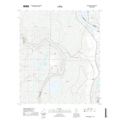
2018 Map of Lower Sunk Lake
USGS Topo · Published 2018About this map
Mississippi River and Red River currents dominate this aquatic landscape where Concordia Parish meets the Mississippi state line. The confluence of river-born terrain is defined by a dense network of bayous and lakes, including the expansive Lower Sunk Lake and Upper Sunk Lake. Settlements such as Union Point and Jackson Point sit along the high ground near the major river bends, while smaller communities like Black Hawk and Shaw anchor the eastern side of the quadrangle. The interior is largely uninhabited, characterized by names that reflect the challenging environment, such as Dismal Swamp and Devils Swamp. Transport through this wetland region relies on routes like the Black Hawk Acme Levee Rd and State Rte 910, which navigate around features like Grand Cutoff Bayou and Bayou Cocodrie.
Find a feature on this map
57 named features on this map. Tap any name to fly to it.
Don’t see what you’re looking for? This feature index may not catch every label — zoom into the map to look around manually.
Map Details
Editions of this 2018 Lower Sunk Lake Map
This is the sole edition of this map. No revisions or reprints were ever made.
Other maps of this area

1935 · Tooleys
USGS Topo · 1:62,500

1939 · Artonish
USGS Topo · 1:62,500

1939 · Deer Park
USGS Topo · 1:62,500

1941 · Voorhies
USGS Topo · 1:62,500

1941 · Tooleys
USGS Topo · 1:62,500

1953 · Natchez
USGS Topo · 1:250,000

1954 · Artonish
USGS Topo · 1:62,500

1955 · Artonish
USGS Topo · 1:62,500

1956 · Natchez
USGS Topo · 1:250,000

1958 · Artonish
USGS Topo · 1:62,500