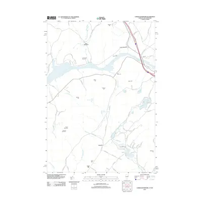
2012 Map of Lower Waterford
USGS Topo · Published 2012About this map
The Connecticut River carves a deep valley between New Hampshire and Vermont, anchoring a landscape defined by sharp elevation changes and secluded water bodies. Small settlements like Lower Waterford and West Waterford sit along the northern banks, while higher ground to the south is marked by peaks such as Chamberlin Mountain and Gardner Mountain. The presence of Mining Hill suggests a history of local resource extraction, while the Ogontz White Mountain Camp near Ogontz Lake points to the region's long-standing role as a destination for seasonal recreation. Topography is further complicated by numerous brooks, including Scarritt Brook and Patten Brook, which drain into the main river system. This survey reveals a transition from riverside hamlets to high-elevation timberlands, preserved through precise contouring of the surrounding hills like Foster Hill and Mormon Hill.
Find a feature on this map
102 named features on this map. Tap any name to fly to it.
Don’t see what you’re looking for? This feature index may not catch every label — zoom into the map to look around manually.
Map Details
Editions of this 2012 Lower Waterford Map
This is the sole edition of this map. No revisions or reprints were ever made.
Other maps of this area

1929 · Moosilauke
USGS Topo · 1:62,500

1931 · Littleton
USGS Topo · 1:62,500

1931 · Woodsville
USGS Topo · 1:48,000

1932 · Littleton
USGS Topo · 1:48,000

1932 · Moosilauke
USGS Topo · 1:62,500

1935 · Woodsville
USGS Topo · 1:62,500

1935 · Littleton
USGS Topo · 1:62,500

1938 · St. Johnsbury
USGS Topo · 1:48,000

1941 · Woodsville
USGS Topo · 1:62,500

1943 · St. Johnsbury
USGS Topo · 1:62,500