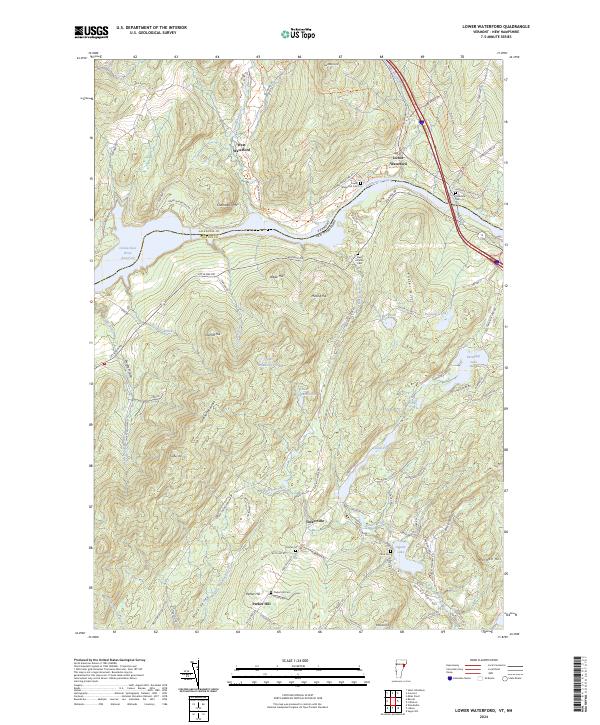
2024 Map of Lower Waterford
USGS Topo · Published 2024About this map
Lower Waterford and West Waterford sit along the northern banks of the Connecticut River, where the landscape transitions from the river valley into the high ridges of Chamberlin Mtn and Gardner Mountain. This contemporary survey illustrates the rural character of the border between Caledonia Co, Vermont, and Grafton Co, New Hampshire, defined by the expansive Connecticut River Reservoir. The area is dotted with small, historically significant sites such as Tinkerville and Sunny Valley, which maintain their identity amidst a network of mountain roads like Lang Rd and Parker Hill Rd.
Find a feature on this map
97 named features on this map. Tap any name to fly to it.
Don’t see what you’re looking for? This feature index may not catch every label — zoom into the map to look around manually.
Map Details
Editions of this 2024 Lower Waterford Map
This is the sole edition of this map. No revisions or reprints were ever made.
Other maps of this area

1929 · Moosilauke
USGS Topo · 1:62,500

1931 · Littleton
USGS Topo · 1:62,500

1931 · Woodsville
USGS Topo · 1:48,000

1932 · Littleton
USGS Topo · 1:48,000

1932 · Moosilauke
USGS Topo · 1:62,500

1935 · Woodsville
USGS Topo · 1:62,500

1935 · Littleton
USGS Topo · 1:62,500

1938 · St. Johnsbury
USGS Topo · 1:48,000

1941 · Woodsville
USGS Topo · 1:62,500

1943 · St. Johnsbury
USGS Topo · 1:62,500