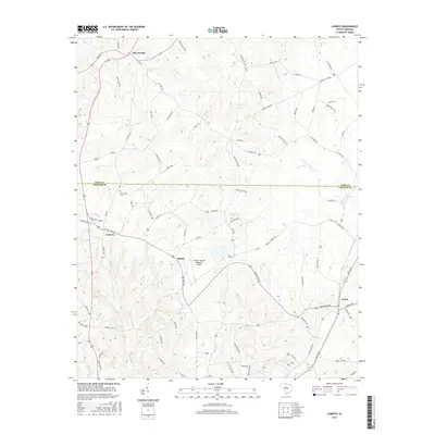
2017 Map of Lowrys
USGS Topo · Published 2017About this map
McConnells and Lowrys serve as the primary hubs in this South Carolina landscape, which straddles the boundary between York Co and Chester Co. The area is defined by a dense network of country roads and family-named thoroughfares such as Davis Lever Rd and Mobley Store Rd, suggesting a long-established agricultural and residential community. Small settlements like Dinber and Lewis punctuate the rail and road corridors, while Zion Cem near the northern border of Chester County provides a focal point for genealogical interest.
Find a feature on this map
77 named features on this map. Tap any name to fly to it.
Don’t see what you’re looking for? This feature index may not catch every label — zoom into the map to look around manually.
Map Details
Editions of this 2017 Lowrys Map
This is the sole edition of this map. No revisions or reprints were ever made.
Other maps of this area

1907 · Sharon
USGS Topo · 1:62,500

1941 · Spartanburg
USGS Topo · 1:250,000

1949 · Rock Hill
USGS Topo · 1:62,500

1953 · Spartanburg
USGS Topo · 1:250,000

1960 · Spartanburg
USGS Topo · 1:250,000

1963 · Spartanburg
USGS Topo · 1:250,000

1964 · Spartanburg
USGS Topo · 1:250,000
1969 · Richburg
USGS Topo · 1:24,000

1969 · Baton Rouge
USGS Topo · 1:24,000
1969 · Chester
USGS Topo · 1:24,000