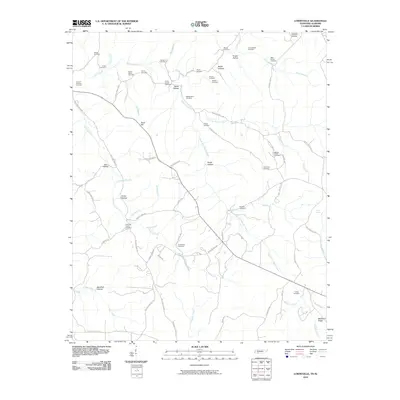
2010 Map of Lowryville
USGS Topo · Published 2010About this map
Horse Creek and its many tributaries, including Math Branch, Petty Branch, and Rogers Creek, dominate this section of the Tennessee-Alabama borderlands. The landscape is defined by a dense network of family-named cemeteries and hollows, suggesting a deeply rooted rural community structure. Genealogists can find several notable burial sites such as Franks Store Cemetery, Faint Hope Cemetery, and Whites Creek Cemetery. The terrain rises toward Sand Hill and Manbone Ridge, while the drainage system of Whites Creek and Holland Creek creates a complex series of valleys including Davis Hollow and Frazier Hollow. This survey captures the rural infrastructure of the early 21st century, where winding roads like Cherry Chapel Loop and Number Two Rd connect isolated homesteads and small farmsteads across the county line.
Find a feature on this map
74 named features on this map. Tap any name to fly to it.
Don’t see what you’re looking for? This feature index may not catch every label — zoom into the map to look around manually.
Map Details
Editions of this 2010 Lowryville Map
This is the sole edition of this map. No revisions or reprints were ever made.
Other maps of this area

1905 · Waynesboro
USGS Topo · 1:125,000

1911 · Iuka
USGS Topo · 1:48,000

1914 · Iuka
USGS Topo · 1:62,500

1924 · Gravelly Springs
USGS Topo · 1:48,000

1926 · Gravelly Springs
USGS Topo · 1:62,500

1935 · Wright
USGS Topo · 1:24,000

1936 · Savannah
USGS Topo · 1:24,000

1936 · Wolf Pit Ridge
USGS Topo · 1:24,000

1936 · Waterloo
USGS Topo · 1:24,000

1936 · Shaws
USGS Topo · 1:24,000