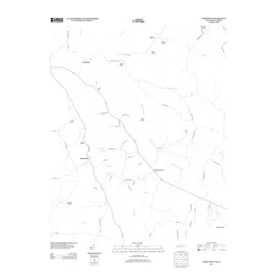
2013 Map of Lowryville
USGS Topo · Published 2013About this map
Lowryville and its surrounding rural hamlets are centered around the vital artery of Highway 69 in this 2013 survey of Hardin County. The landscape is defined by a dense network of watercourses and naming conventions that reveal a deeply established local history, from the waters of Horse Cr and Holland Cr to the various divisions of Whites Cr. The topography is marked by named geographic basins such as Clover Hollow, Davis Hollow, and Wildcat Hollow, which dictate the placement of local roads and smaller settlements like Walnut Grove and Big Ivy.
Find a feature on this map
77 named features on this map. Tap any name to fly to it.
Don’t see what you’re looking for? This feature index may not catch every label — zoom into the map to look around manually.
Map Details
Editions of this 2013 Lowryville Map
This is the sole edition of this map. No revisions or reprints were ever made.
Other maps of this area

1905 · Waynesboro
USGS Topo · 1:125,000

1911 · Iuka
USGS Topo · 1:48,000

1914 · Iuka
USGS Topo · 1:62,500

1924 · Gravelly Springs
USGS Topo · 1:48,000

1926 · Gravelly Springs
USGS Topo · 1:62,500

1935 · Wright
USGS Topo · 1:24,000

1936 · Savannah
USGS Topo · 1:24,000

1936 · Wolf Pit Ridge
USGS Topo · 1:24,000

1936 · Waterloo
USGS Topo · 1:24,000

1936 · Shaws
USGS Topo · 1:24,000