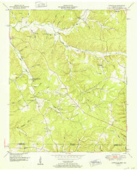
1952 Map of Lowryville
USGS Topo · Published 1952About this map
Lowryville sits at the heart of this post-war landscape, situated where the undulating hills of southern Tennessee meet the Alabama border. The settlement pattern is defined by narrow hollows and creek drainage systems, where small communities like Walnut Grove and Pollards Mill developed along the watercourses. This 1949 field examination reveals a high density of rural institutions, with numerous country churches such as Upper Holland Creek Church and Duncan Chapel serving family farms. The frequency of family-named burial grounds, including Stricklin Cem and Fielder Cem, alongside unique landmarks like Clock Spring, provides a detailed record of local genealogy before later 20th-century modernization. The area is heavily dissected by branches of Horse Creek and Holland Creek, with transport restricted to the ridges and valley floors, connecting isolated locales like Sand Hill to the larger township network.
Find a feature on this map
76 named features on this map. Tap any name to fly to it.
Don’t see what you’re looking for? This feature index may not catch every label — zoom into the map to look around manually.
Map Details
Editions of this 1952 Lowryville Map
This is the sole edition of this map. No revisions or reprints were ever made.
Other maps of this area

1905 · Waynesboro
USGS Topo · 1:125,000

1911 · Iuka
USGS Topo · 1:48,000

1914 · Iuka
USGS Topo · 1:62,500

1924 · Gravelly Springs
USGS Topo · 1:48,000

1926 · Gravelly Springs
USGS Topo · 1:62,500

1935 · Wright
USGS Topo · 1:24,000

1936 · Savannah
USGS Topo · 1:24,000

1936 · Wolf Pit Ridge
USGS Topo · 1:24,000

1936 · Waterloo
USGS Topo · 1:24,000

1936 · Shaws
USGS Topo · 1:24,000