
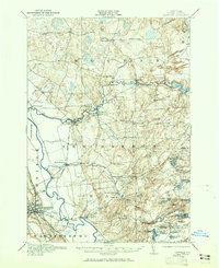
1911 Map of Lowville
USGS Topo · Published 1959About this map
The confluence of the Black River and the Beaver River anchors this pre-World War I survey of central Lewis County, showcasing a landscape defined by water power and rural education. The industrial footprint of the era is evident at Beaver Falls and Croghan, where a Power Plant and various reservoirs like the Carthage Reservoir supported local growth. Transport is dominated by the Utica Line railroad corridor and historic river access points such as Bushes Landing on the Black River.
Find a feature on this map
78 named features on this map. Tap any name to fly to it.
Don’t see what you’re looking for? This feature index may not catch every label — zoom into the map to look around manually.
Map Details
Editions of this 1911 Lowville Map
2 editions found
Other maps of this area

1902 · Carthage
USGS Topo · 1:62,500

1904 · Carthage
USGS Topo · 1:62,500

1905 · Port Leyden
USGS Topo · 1:62,500

1906 · Highmarket
USGS Topo · 1:62,500

1907 · Port Leyden
USGS Topo · 1:62,500

1911 · Antwerp
USGS Topo · 1:62,500

1912 · Number Four
USGS Topo · 1:62,500

1912 · Mc Keever
USGS Topo · 1:62,500

1913 · Lowville
USGS Topo · 1:62,500

1913 · Lake Bonaparte
USGS Topo · 1:62,500