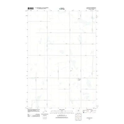
2012 Map of Loyalton
USGS Topo · Published 2012About this map
The small prairie settlement of Loyalton serves as the focal point of this North Central South Dakota landscape, characterized by the rigid section-line grid of the Great Plains. The township is defined by a network of local thoroughfares including 346th Ave and 145th St, which organize the agricultural land into precise square-mile blocks. A key site for local history and genealogy is the Loyalton Cem, situated to the north of the main cluster of buildings. The topography is dotted with numerous small, ephemeral wetlands and depressions typical of the Missouri Coteau region, shown here as they appeared in the early 21st century. This survey provides a clear view of the rural infrastructure, capturing the layout of farmsteads and access roads like 342nd Ave and 140th St that have sustained this Edmunds County community for generations.
Find a feature on this map
17 named features on this map. Tap any name to fly to it.
Don’t see what you’re looking for? This feature index may not catch every label — zoom into the map to look around manually.
Map Details
Editions of this 2012 Loyalton Map
This is the sole edition of this map. No revisions or reprints were ever made.
Other maps of this area

1950 · Onaka
USGS Topo · 1:24,000

1951 · Clark Lake
USGS Topo · 1:24,000

1952 · Onaka
USGS Topo · 1:24,000

1952 · Norbeck
USGS Topo · 1:24,000

1954 · Aberdeen
USGS Topo · 1:250,000

1956 · Aberdeen
USGS Topo · 1:250,000

1965 · Onaka
USGS Topo · 1:24,000

1974 · Roscoe
USGS Topo · 1:24,000

1974 · Roscoe SW
USGS Topo · 1:24,000

1978 · Loyalton
USGS Topo · 1:24,000