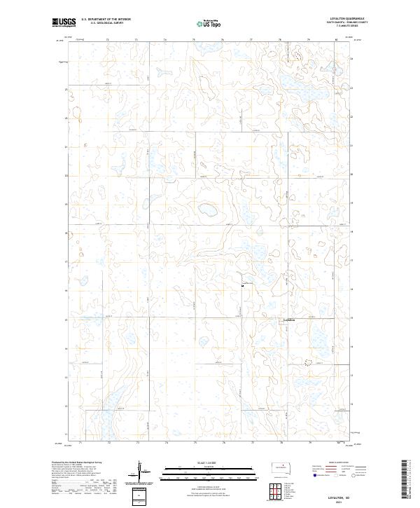
2021 Map of Loyalton
USGS Topo · Published 2021About this map
Loyalton remains the central point of reference in this sparsely settled region of Edmunds County, situated at the intersection of Co Rd 12 and 3rd St. The landscape is characterized by a high density of small seasonal wetlands and depressions, common to the glacial pothole region of the Dakotas. These water features are interspersed among a rigid section-line road grid, including 140th St, 143rd St, and 147th St, which dictate the movement of agriculture and commerce across the prairie. A mile north of the primary settlement, the Loyalton Cem serves as a significant landmark for genealogists and local historians, reflecting the generations of families who established farms in these townships. The map provides a clear look at the enduring township and range system, specifically defining the boundaries of t121n r70w and surrounding areas.
Find a feature on this map
23 named features on this map. Tap any name to fly to it.
Don’t see what you’re looking for? This feature index may not catch every label — zoom into the map to look around manually.
Map Details
Editions of this 2021 Loyalton Map
This is the sole edition of this map. No revisions or reprints were ever made.
Other maps of this area

1950 · Onaka
USGS Topo · 1:24,000

1951 · Clark Lake
USGS Topo · 1:24,000

1952 · Onaka
USGS Topo · 1:24,000

1952 · Norbeck
USGS Topo · 1:24,000

1954 · Aberdeen
USGS Topo · 1:250,000

1956 · Aberdeen
USGS Topo · 1:250,000

1965 · Onaka
USGS Topo · 1:24,000

1974 · Roscoe
USGS Topo · 1:24,000

1974 · Roscoe SW
USGS Topo · 1:24,000

1978 · Loyalton
USGS Topo · 1:24,000