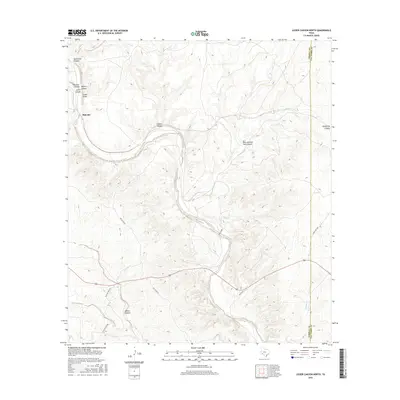
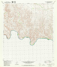
2016 Map of Lozier Canyon North
USGS Topo · Published 2016About this map
Malvado sits at the western edge of this West Texas landscape, where the Southern Pacific railroad line once defined the local geography of Terrell County. The terrain is dominated by a complex network of dry washes and deep incisions, most notably the meandering Lozier Canyon which carves through the limestone plateaus. This 2016 survey illustrates the persistent ranching and transportation infrastructure that connects this isolated region to the outside world, including Ranch Rd 1865 and Big Lozier Rd. To the east, the landscape transitions across the Terrell and Val Verde County line, marked by landmarks such as Pumpville Canyon and Mile and One Half Canyon. The map records a series of named drainages like Sevenmile Canyon, Coyote Canyon, and Jones Draw, reflecting a topography defined by occasional but powerful water flow through an otherwise arid environment.
Find a feature on this map
28 named features on this map. Tap any name to fly to it.
Don’t see what you’re looking for? This feature index may not catch every label — zoom into the map to look around manually.
Map Details
Editions of this 2016 Lozier Canyon North Map
This is the sole edition of this map. No revisions or reprints were ever made.
Other maps of this area
1943 · Malvado
USGS Topo · 1:62,500
1943 · Langtry
USGS Topo · 1:62,500
1944 · Malvado
USGS Topo · 1:62,500

1954 · Sonora
USGS Topo · 1:250,000

1958 · Sonora
USGS Topo · 1:250,000
1958 · Del Rio
USGS Topo · 1:250,000
1964 · Del Rio
USGS Topo · 1:250,000
1979 · Cook Creek North
USGS Topo · 1:24,000
1979 · Lozier Canyon North
USGS Topo · 1:24,000
1979 · Cook Creek South
USGS Topo · 1:24,000