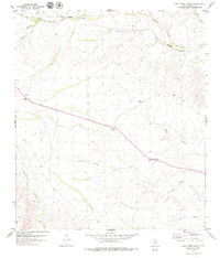
1979 Map of Cook Creek North
USGS Topo · Published 1979About this map
Thurston Canyon and the surrounding high desert terrain define this West Texas landscape in the late 1970s. The northern portion of the map is dominated by the Southern Pacific rail line and a prominent Old Railroad Grade, tracing the historical movement of steam and diesel through these drainages. Human activity is concentrated along these transport corridors and the diagonal path of Highway 90. Isolated outposts like the Rock House Ranch and the small Cem near the canyon rim offer a look into the ranching and local history of this Terrell County region. To the south, the landscape is carved by seasonal waterways including Cook Creek, Cedar Creek, and Cow Creek. Landmarks such as Cedar Station and various Gravel Pits indicate the utility of the land, while a solitary Radio Tower and several Wells dot the expansive plateaus between the deep-cut canyons of Palma Canyon and Meyers Canyon.
Find a feature on this map
26 named features on this map. Tap any name to fly to it.
Don’t see what you’re looking for? This feature index may not catch every label — zoom into the map to look around manually.
Map Details
Editions of this 1979 Cook Creek North Map
This is the sole edition of this map. No revisions or reprints were ever made.
Other maps of this area

1918 · Dryden Crossing
USGS Topo · 1:62,500

1928 · Sanderson
USGS Topo · 1:125,000

1943 · Malvado
USGS Topo · 1:62,500

1944 · Malvado
USGS Topo · 1:62,500

1954 · Fort Stockton
USGS Topo · 1:250,000

1954 · Sonora
USGS Topo · 1:250,000

1958 · Sonora
USGS Topo · 1:250,000

1958 · Fort Stockton
USGS Topo · 1:250,000

1958 · Del Rio
USGS Topo · 1:250,000

1959 · Emory Peak
USGS Topo · 1:250,000