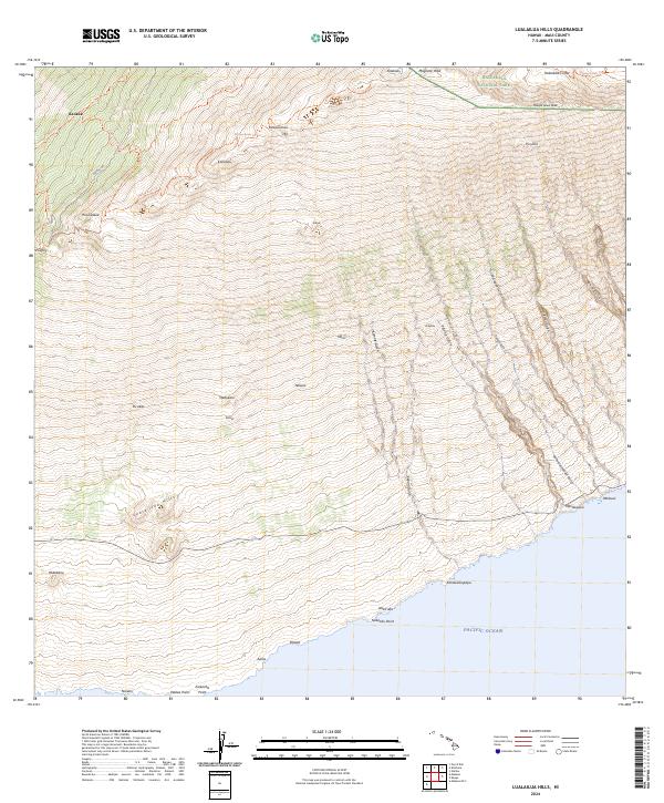
2024 Map of Lualailua Hills
USGS Topo · Published 2024About this map
Haleakalā National Park and the Haleakalā Wilderness dominate the northern volcanic landscape, where the high-altitude Haleakalā Crater sits among summits like Magnetic Peak and Haupa‘akea Peak. The topography descends sharply toward the Pacific Ocean to the south, carved by numerous drainage features including Kepuni Gulch, Paldha Gulch, and Kamole Gulch.
Find a feature on this map
50 named features on this map. Tap any name to fly to it.
Don’t see what you’re looking for? This feature index may not catch every label — zoom into the map to look around manually.
Map Details
Editions of this 2024 Lualailua Hills Map
This is the sole edition of this map. No revisions or reprints were ever made.
Other maps of this area

1954 · Maui
USGS Topo · 1:250,000

1954 · Puu O Kali
USGS Topo · 1:24,000

1954 · Makena
USGS Topo · 1:24,000

1957 · Kilohana
USGS Topo · 1:24,000

1957 · Lualailua Hills
USGS Topo · 1:24,000

1957 · Nahiku
USGS Topo · 1:24,000

1957 · Kaupo
USGS Topo · 1:24,000

1966 · Maui
USGS Topo · 1:250,000

1974 · Maui
USGS Topo · 1:250,000
1983 · Lualailua Hills
USGS Topo · 1:24,000