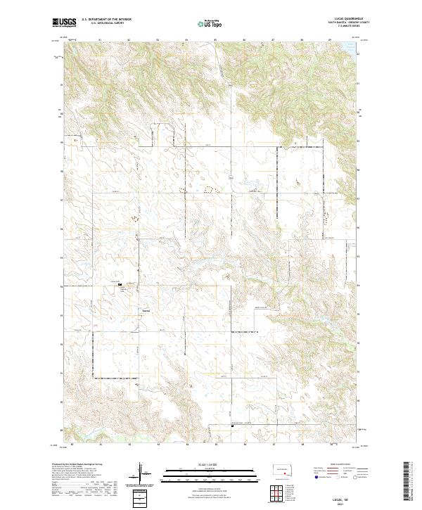
2021 Map of Lucas
USGS Topo · Published 2021About this map
Lucas serves as the focal point of this Gregory County landscape, situated atop the high prairie between the drainage basins of the Missouri River and the White River. The area is defined by its deep commitment to local history and community, evidenced by the clustered presence of the Lucas Cem and Lucas Catholic Cem. To the northeast, the terrain slopes toward the expansive waters of Lake Francis Case, while the interior of the quadrangle is dissected by the seasonal flows of the N Fork Whetstone Cr and the S Fork Whetstone Cr. The road network, including State Hwy 1806 and family-named routes like Dewey Hills Rd, follows the section lines of the Public Land Survey System, illustrating a classic Midwestern agricultural grid that has persisted into the modern era.
Find a feature on this map
38 named features on this map. Tap any name to fly to it.
Don’t see what you’re looking for? This feature index may not catch every label — zoom into the map to look around manually.
Map Details
Editions of this 2021 Lucas Map
This is the sole edition of this map. No revisions or reprints were ever made.
Other maps of this area

1955 · Mitchell
USGS Topo · 1:250,000

1959 · Mitchell
USGS Topo · 1:250,000

1964 · Herrick NW
USGS Topo · 1:24,000

1964 · Herrick NE
USGS Topo · 1:24,000
1964 · Burke
USGS Topo · 1:24,000

1971 · Lucas NW
USGS Topo · 1:24,000

1971 · Academy
USGS Topo · 1:24,000

1971 · Lucas
USGS Topo · 1:24,000

1971 · Dixon SE
USGS Topo · 1:24,000

1971 · Dixon NE
USGS Topo · 1:24,000