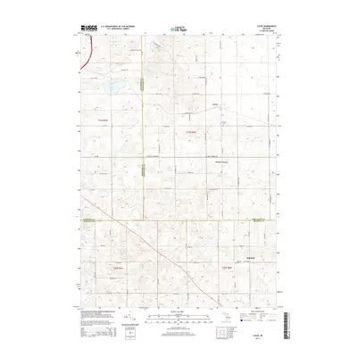
2014 Map of Lucas
USGS Topo · Published 2014About this map
Lucas and Stoney Corner anchor this rural landscape in Northern Michigan, where the intersections of county roads define the local community structure. The map reveals a land organized by the Public Land Survey System, with a dense network of sectional roads such as W Stoney Corners Rd and Pleasant Valley Rd facilitating travel between farms and small settlements. In the southern portion, the hamlet of Highland sits near the county line, while the presence of Richland Cem and Hillside Cem provides significant reference points for genealogists tracking families in the area. The terrain is marked by gentle drainage through Marks Cr and the presence of Berry Lake in the northwest, illustrating the quiet, agrarian character of the Wexford and Missaukee county borderlands during the early 21st century.
Find a feature on this map
35 named features on this map. Tap any name to fly to it.
Don’t see what you’re looking for? This feature index may not catch every label — zoom into the map to look around manually.
Map Details
Editions of this 2014 Lucas Map
This is the sole edition of this map. No revisions or reprints were ever made.
Other maps of this area

1954 · Traverse City
USGS Topo · 1:250,000

1956 · Cadillac North
USGS Topo · 1:62,500

1956 · Lake City
USGS Topo · 1:62,500

1957 · Cadillac South
USGS Topo · 1:62,500

1957 · Marion
USGS Topo · 1:62,500

1958 · Traverse City
USGS Topo · 1:250,000
1983 · Dighton
USGS Topo · 1:25,000

1983 · Cadillac
USGS Topo · 1:100,000
1983 · Le Roy
USGS Topo · 1:25,000

1983 · Lake City
USGS Topo · 1:25,000