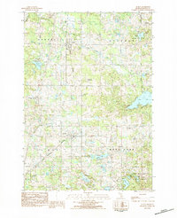
1983 Map of Le Roy
USGS Topo · Published 1984About this map
The villages of Tustin and Le Roy anchor this rural landscape in the early 1980s, situated along the corridor of the Michigan Northern railroad. This region is defined by a dense concentration of glacial kettle lakes and wetlands, particularly within the Pere Marquette State Forest at the southern edge. The mapping reveals a community-focused infrastructure, from the Pine River Area High Sch to several local burial grounds including Maple Hill Cem and Rose Lake Cem.
Find a feature on this map
45 named features on this map. Tap any name to fly to it.
Don’t see what you’re looking for? This feature index may not catch every label — zoom into the map to look around manually.
Map Details
Editions of this 1983 Le Roy Map
This is the sole edition of this map. No revisions or reprints were ever made.
Other maps of this area

1931 · Chase NE
USGS Topo · 1:31,680

1933 · Luther SE
USGS Topo · 1:31,680

1954 · Traverse City
USGS Topo · 1:250,000

1954 · Midland
USGS Topo · 1:250,000

1957 · Cadillac South
USGS Topo · 1:62,500

1957 · Luther
USGS Topo · 1:62,500

1958 · Traverse City
USGS Topo · 1:250,000

1958 · Midland
USGS Topo · 1:250,000

1959 · Midland
USGS Topo · 1:250,000

1959 · Evart
USGS Topo · 1:62,500