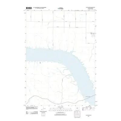
2012 Map of Lucas NW
USGS Topo · Published 2012About this map
Lake Francis Case dominates the landscape of this Missouri River reach, where the water bifurcates the prairie of Brule and Gregory counties. The eastern bank is marked by the communal settlement at Platte Colony, situated just north of the notable Platte-Winner Bridge crossing. The terrain transitions from the upland agricultural grids defined by Farmers Rd and various numbered avenues to the dissected breaks along the reservoir. Tributaries like Snake Cr and Rush Cr cut through the bluffs, while Red Rock stands as a prominent landmark on the western shore. The road network, including Buryanek Rd, reflects the modern rural infrastructure supporting both agricultural interests and access to the river's expansive water resources.
Find a feature on this map
18 named features on this map. Tap any name to fly to it.
Don’t see what you’re looking for? This feature index may not catch every label — zoom into the map to look around manually.
Map Details
Editions of this 2012 Lucas NW Map
This is the sole edition of this map. No revisions or reprints were ever made.
Other maps of this area

1940 · Iona
USGS Topo · 1:62,500

1944 · Iona
USGS Topo · 1:62,500

1955 · Mitchell
USGS Topo · 1:250,000

1959 · Mitchell
USGS Topo · 1:250,000

1971 · Lucas NW
USGS Topo · 1:24,000

1971 · Academy
USGS Topo · 1:24,000

1971 · Lucas
USGS Topo · 1:24,000

1971 · Dixon SE
USGS Topo · 1:24,000

1971 · Dixon NE
USGS Topo · 1:24,000

1971 · Lucas SE
USGS Topo · 1:24,000
Featured Places
- America Township, SD
- La Roche Township, SD
- Eagle Township, SD
- Platte Hutterite Colony, SD
- Charles Mix County, SD