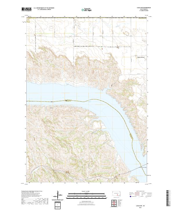
2021 Map of Lucas NW
USGS Topo · Published 2021About this map
Lake Francis Case dominates this Missouri River landscape, marking the boundary between Charles Mix and Gregory counties. The map captures a transition from the structured agricultural grid of the high plains to the deeply eroded breaks along the river valley. To the northeast, Platte Colony sits amidst a network of rural routes like 352nd Ave and 270th St, while the rugged shoreline to the south reveals the complex topography of the river bluffs. In the southeast, the Platte-Winner Bridge provides a critical crossing point over the reservoir, connecting the two counties. Smaller watercourses like Snake Cr and Rush Cr carve through the terrain, illustrating the natural drainage patterns that defined local land use and road placement, such as Buryanek Rd, as the region adapted to the massive dam projects of the mid-20th century.
Find a feature on this map
54 named features on this map. Tap any name to fly to it.
Don’t see what you’re looking for? This feature index may not catch every label — zoom into the map to look around manually.
Map Details
Editions of this 2021 Lucas NW Map
This is the sole edition of this map. No revisions or reprints were ever made.
Other maps of this area

1940 · Iona
USGS Topo · 1:62,500

1944 · Iona
USGS Topo · 1:62,500

1955 · Mitchell
USGS Topo · 1:250,000

1959 · Mitchell
USGS Topo · 1:250,000

1971 · Lucas NW
USGS Topo · 1:24,000

1971 · Academy
USGS Topo · 1:24,000

1971 · Lucas
USGS Topo · 1:24,000

1971 · Dixon SE
USGS Topo · 1:24,000

1971 · Dixon NE
USGS Topo · 1:24,000

1971 · Lucas SE
USGS Topo · 1:24,000
Featured Places
- America Township, SD
- Eagle Township, SD
- La Roche Township, SD
- Platte Hutterite Colony, SD
- Charles Mix County, SD