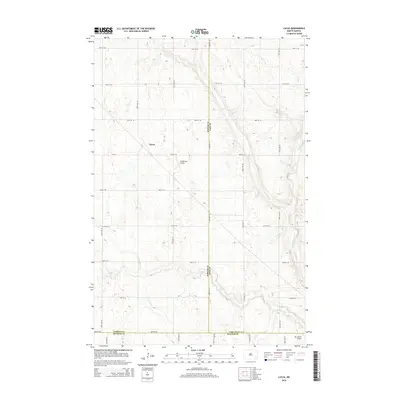
2014 Map of Lucca
USGS Topo · Published 2014About this map
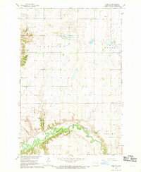
Lucca sits at the heart of this agricultural landscape in southeastern North Dakota, where the section-line road grid dominates the terrain. This 2014 survey captures a rural environment defined by the meandering course of the Maple River, which carves a distinct valley through the eastern portion of the quadrangle. The intersection of CR-38 and 130th Ave SE marks the center of the local transport network, connecting the scattered homesteads of the prairie. The presence of small aviation facilities like Lindemann Airport and Sky Haven Airport reflects the practical necessities of travel and crop management in this wide-open region. Spanning the borders where Barnes, Cass, and Ransom counties meet, the map illustrates the enduring spatial organization of the northern plains, characterized by its orderly townships and the persistence of small rural hubs.
Find a feature on this map
25 named features on this map. Tap any name to fly to it.
Don’t see what you’re looking for? This feature index may not catch every label — zoom into the map to look around manually.
Map Details
Editions of this 2014 Lucca Map
This is the sole edition of this map. No revisions or reprints were ever made.
Other maps of this area
1897 · Tower
USGS Topo · 1:125,000

1953 · Fargo
USGS Topo · 1:250,000

1956 · Fargo
USGS Topo · 1:250,000
1960 · Enderlin South
USGS Topo · 1:24,000
1961 · Enderlin North
USGS Topo · 1:24,000
1965 · Alice
USGS Topo · 1:24,000
1965 · Lucca
USGS Topo · 1:24,000
1965 · Tower City SW
USGS Topo · 1:24,000
1967 · Fingal
USGS Topo · 1:24,000
1967 · Nome SE
USGS Topo · 1:24,000