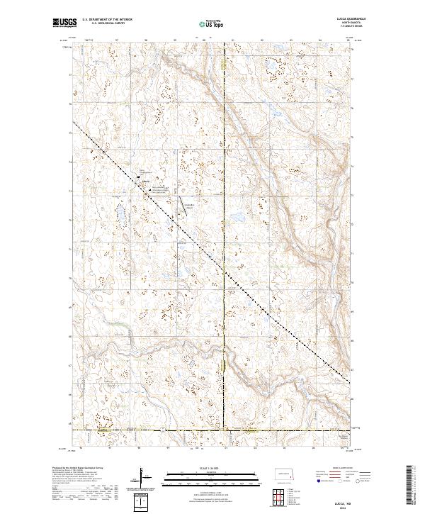
2024 Map of Lucca
USGS Topo · Published 2024About this map
The settlement of Lucca serves as the focal point for this rural landscape where the southeastern corner of Barnes County meets Cass and Ransom. The geography is characterized by the meandering path of the Maple River in the east and the extensive Barnes County Waterfowl Production Area in the west, illustrating the region's dedication to conservation. For those researching family history in the area, the map precisely locates the Lucca Congregational Cem and the Trinity Lutheran Cem / Emmanuel Lutheran Cem / Lucca Cem, two critical sites for local genealogical study. The presence of both the Lindemann Airport and Sky Haven Airport suggests a reliance on small-scale aviation within this agricultural prairie community, while the grid of section roads like 50th St SE and Co Hwy 38 organizes the sprawling farmsteads.
Find a feature on this map
28 named features on this map. Tap any name to fly to it.
Don’t see what you’re looking for? This feature index may not catch every label — zoom into the map to look around manually.
Map Details
Editions of this 2024 Lucca Map
This is the sole edition of this map. No revisions or reprints were ever made.
Other maps of this area

1897 · Tower
USGS Topo · 1:125,000

1953 · Fargo
USGS Topo · 1:250,000

1956 · Fargo
USGS Topo · 1:250,000

1960 · Enderlin South
USGS Topo · 1:24,000

1961 · Enderlin North
USGS Topo · 1:24,000

1965 · Alice
USGS Topo · 1:24,000

1965 · Lucca
USGS Topo · 1:24,000

1965 · Tower City SW
USGS Topo · 1:24,000

1967 · Fingal
USGS Topo · 1:24,000
1967 · Nome SE
USGS Topo · 1:24,000