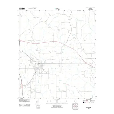
2012 Map of Lucedale
USGS Topo · Published 2012About this map
Lucedale serves as the primary urban center for this George County region, showing a dense street grid that includes the Po and several municipal cemeteries. To the southeast, the smaller settlement of Evanston sits near the confluence of local drainages, while Luce Farms indicates the agricultural character of the outlying landscape. This territory is heavily marked by a network of family-named roads such as Leroy Havard Rd and Billie Tilley Hl, reflecting long-standing local landownership patterns. The hydrology is defined by numerous waterways including Beaverdam Cr and Rocky Cr, which feed into larger systems. Genealogists will find a significant distribution of burial sites across the landscape, from the centrally located Magnolia Garden Cem and Rhymes Cem to the outlying New Antioch Cem and Rocky Creek Cem, documenting the area's generational residency.
Find a feature on this map
154 named features on this map. Tap any name to fly to it.
Don’t see what you’re looking for? This feature index may not catch every label — zoom into the map to look around manually.
Map Details
Editions of this 2012 Lucedale Map
This is the sole edition of this map. No revisions or reprints were ever made.
Other maps of this area

1941 · Lucedale
USGS Topo · 1:62,500

1942 · Deer Park
USGS Topo · 1:62,500

1942 · Wilmer
USGS Topo · 1:62,500

1943 · Lucedale
USGS Topo · 1:62,500

1943 · Deer Park
USGS Topo · 1:62,500

1944 · Wilmer
USGS Topo · 1:62,500

1953 · Hattiesburg
USGS Topo · 1:250,000

1953 · Mobile
USGS Topo · 1:250,000

1957 · Mobile
USGS Topo · 1:250,000

1958 · Hattiesburg
USGS Topo · 1:250,000