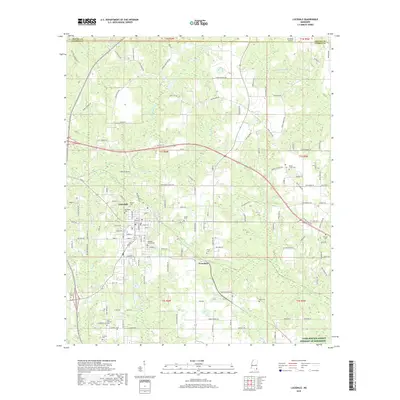
2018 Map of Lucedale
USGS Topo · Published 2018About this map
Lucedale serves as the primary hub of this George County landscape, where the town’s grid meets a radial network of rural roads such as Seldom Rest Rd and Palestine Garden Rd. The map reveals a high concentration of small family and community burial grounds, including Northside Cem, Rhymes Cem, and Magnolia Garden Cem, which provide significant anchor points for local genealogical research. To the southeast, the settlement of Evanston marks the junction of local transit and the drainage of Depot Creek. The terrain is defined by a dense web of watercourses, with Big Creek, Denny Mill Creek, and Little Cedar Creek carving through the township sections. These waterways, coupled with named arteries like Ernest Pipkins Rd and James Day Rd, illustrate the long-standing integration of timber, agriculture, and small-town commerce in this corner of Mississippi.
Find a feature on this map
142 named features on this map. Tap any name to fly to it.
Don’t see what you’re looking for? This feature index may not catch every label — zoom into the map to look around manually.
Map Details
Editions of this 2018 Lucedale Map
This is the sole edition of this map. No revisions or reprints were ever made.
Other maps of this area

1941 · Lucedale
USGS Topo · 1:62,500

1942 · Deer Park
USGS Topo · 1:62,500

1942 · Wilmer
USGS Topo · 1:62,500

1943 · Lucedale
USGS Topo · 1:62,500

1943 · Deer Park
USGS Topo · 1:62,500

1944 · Wilmer
USGS Topo · 1:62,500

1953 · Hattiesburg
USGS Topo · 1:250,000

1953 · Mobile
USGS Topo · 1:250,000

1957 · Mobile
USGS Topo · 1:250,000

1958 · Hattiesburg
USGS Topo · 1:250,000