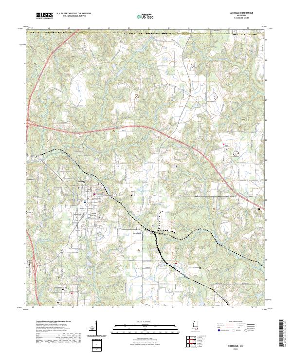
2024 Map of Lucedale
USGS Topo · Published 2024About this map
Lucedale and its neighboring settlement of Evanston anchor this modern survey of George County, Mississippi. As the county seat, Lucedale is defined by its central grid and the George County Courthouse, while the surrounding landscape is partitioned by a network of rural roads often named for the families who settled the area. These include Leroy Havard Rd, James Day Rd, and Henry Eubanks Rd, suggesting a landscape shaped by lineage and property lines.
Find a feature on this map
151 named features on this map. Tap any name to fly to it.
Don’t see what you’re looking for? This feature index may not catch every label — zoom into the map to look around manually.
Map Details
Editions of this 2024 Lucedale Map
This is the sole edition of this map. No revisions or reprints were ever made.
Other maps of this area

1941 · Lucedale
USGS Topo · 1:62,500

1942 · Deer Park
USGS Topo · 1:62,500

1942 · Wilmer
USGS Topo · 1:62,500

1943 · Lucedale
USGS Topo · 1:62,500

1943 · Deer Park
USGS Topo · 1:62,500

1944 · Wilmer
USGS Topo · 1:62,500

1953 · Hattiesburg
USGS Topo · 1:250,000

1953 · Mobile
USGS Topo · 1:250,000

1957 · Mobile
USGS Topo · 1:250,000

1958 · Hattiesburg
USGS Topo · 1:250,000