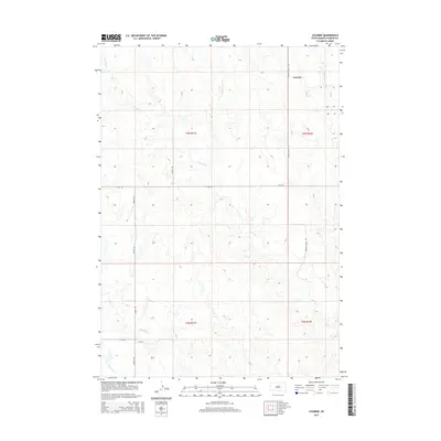
2015 Map of Lucerne
USGS Topo · Published 2015About this map
Lucerne sits in the northeastern corner of this Haakon County landscape, marking a quiet point of settlement within the expansive drainage basins of central South Dakota. The topography is defined by the winding paths of Buzzard Cr and Witcher Holes Cr as they cut through the section lines of the Public Land Survey System. A sparse but functional road network, including the aptly named Tornado Ranch Rd and Airport Rd, suggests the remote, ranch-based economy that persists in this region. To the south, the terrain descends toward the valleys of Medicine Cr and Wilburn Cr, illustrating the vital role of intermittent watercourses in shaping local land use and property boundaries in this part of the Great Plains.
Find a feature on this map
15 named features on this map. Tap any name to fly to it.
Don’t see what you’re looking for? This feature index may not catch every label — zoom into the map to look around manually.
Map Details
Editions of this 2015 Lucerne Map
This is the sole edition of this map. No revisions or reprints were ever made.
Other maps of this area

1953 · Philip
USGS Topo · 1:24,000

1953 · Philip SE
USGS Topo · 1:24,000

1954 · Powell
USGS Topo · 1:24,000

1954 · Pierre
USGS Topo · 1:250,000

1958 · Pierre
USGS Topo · 1:250,000

1983 · Mule Creek
USGS Topo · 1:24,000

1983 · Philip
USGS Topo · 1:100,000
1983 · Elevenmile Corner
USGS Topo · 1:24,000

1983 · Powell NW
USGS Topo · 1:24,000

1983 · Tornado Ranch
USGS Topo · 1:24,000